
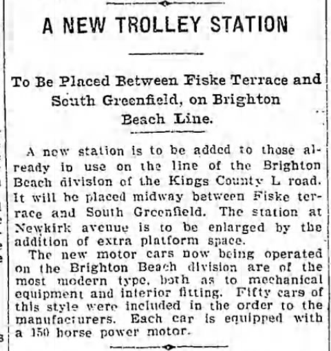
From 1906 to 1908, the tracks of the Manhattan Beach and Brighton railroads south of Avenue H underwent a significant realignment, as illustrated by the maps and photos below. The objective was to bring the two lines very close together on a new embankment so they could share the same bridges to be built over the avenues running east to west from Avenue J to Sheepshead Bay – all part of the massive grade crossing elimination project.
Manhattan Beach Junction
In the 1890 map above, the Brighton railroad, which would be controlled by the Brooklyn Rapid Transit (BRT) Company a decade later, is represented by a hatched black line running from the top center to the bottom. It cuts through the middle of a green splotch representing Lotts Woods, named for the Lott family who owned the land until 1898, and were instrumental in creating the Brighton line in 1878, as well as funding its destination, William Engelman’s new Hotel Brighton in Brighton Beach.
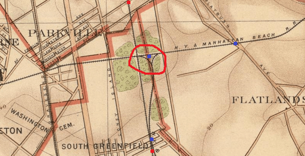
In that Lotts woodland, the “N.Y. & Manhattan Beach RR” (hereafter MBRR) – running from right to left – crosses the Brighton line just below Avenue H (see Part 2). Just to the right of that intersection, two spurs can be seen emanating from the MBRR which shortly unite and form a small triangle. This area, circled in red by my trembling hand, was called Manhattan Beach Junction. The western spur – the left side of the triangle – was eliminated in 1908 after serving as a conduit for the dirt excavated from the Bay Ridge mainline to build the embankments. The road to the right of the MBRR spurs is Ocean Avenue, which would soon sport an electric trolley. (By the way, the dotted line that the triangle straddles — highlighted by the map-maker in a reddish hue — was then the boundary line between the old towns of Flatlands on the right and Gravesend on the left).
The MBRR was the 1877 invention of robber-baron Austin Corbin who was inspired by Engelman’s earlier Ocean Hotel in Brighton Beach to erect something even grander. So he literally robbed the eastern end of Coney Island, dubbed it Manhattan Beach to attract the New York City elite, and built the Manhattan Beach Hotel as part of a large resort. David A. Sullivan’s account of this history makes for a great read.
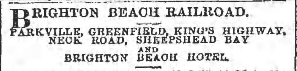
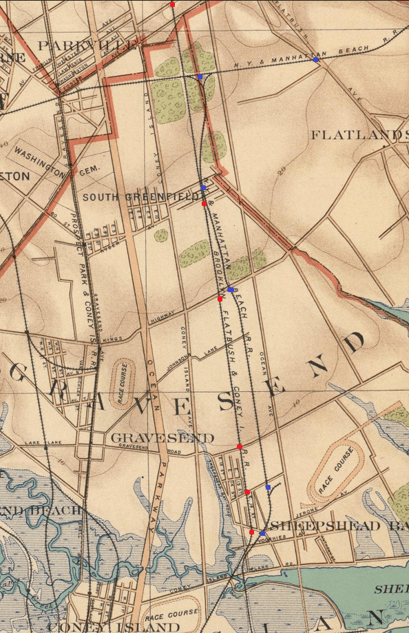
Below you will see a fuller representation of the 1890 map. The Brighton stops are noted by red dots, the MBRR stops by blue. The Brighton trains only stopped “at signal” at Parkville, Greenfield, Kings Highway & Neck Road per this excerpt from a contemporaneous advertisement:
And note the absence of stops at Fiske Terrace (Avenue H) or Manhattan Terrace (Avenue J). They would come later to the Brighton line. Also notice how the MBRR line swerves to the west as it enters South Greenfield, then returns to its eastern path. In 1899, as discussed below, the LIRR attempted to straighten its track bed by moving that station further to the east.
This map and hundreds of other old Brooklyn maps can be found on line. The NY Public Library’s digital collection is a spectacular resource — I’ve found many old Brooklyn maps by searching their “Atlases of New York City” page.
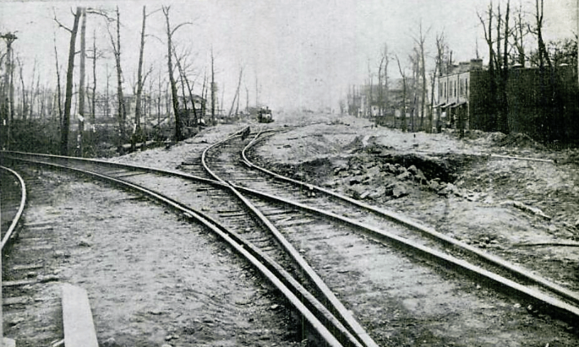
Here are photos from 1906 to 1908 showing the Manhattan Beach Junction area. For a much more informed analysis of these photos – see Arthur John Huneke’s pages on the LIRR and links therein.
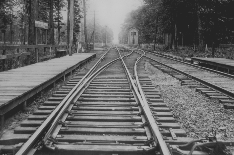


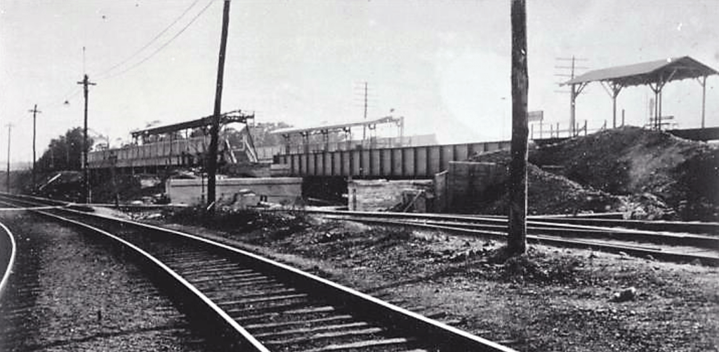
The photo above was taken by the contractor hired by the BRT in order to document his work, one of many used in his lawsuit against the BRT for withheld payments. The Brighton right of way is shown heading south, below the Avenue H station, where an embankment will be built all the way to the shore.
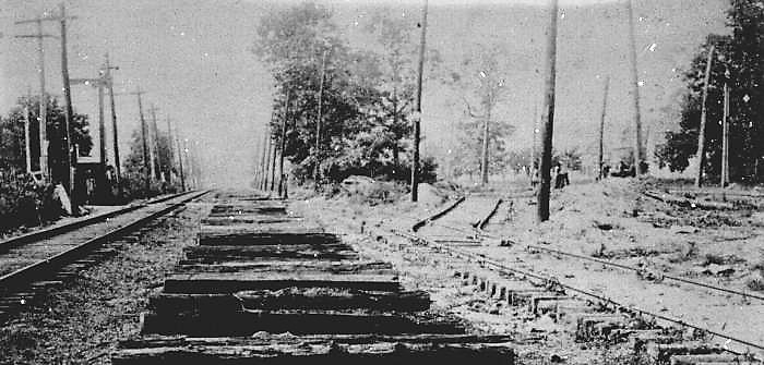
The photo above is looking north from the MBRR tracks near Avenue I. A white, flat-roofed BRT power station is visible on the upper left alongside the Brighton right of way (its decrepit hulk still survives, per far below), while on the far right, a new westbound MBRR track is being built. The track in the middle will be torn up and the track on the left will be the lone southbound track.
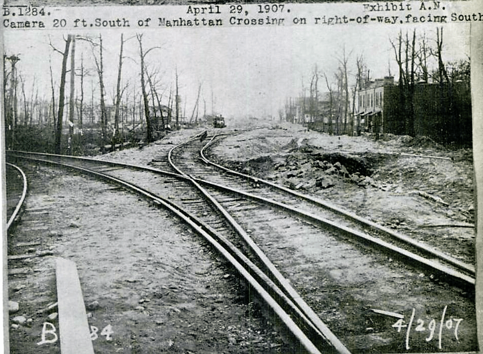
The location above is midway between Manhattan Beach Junction and Avenue J. MBRR northbound rails have been removed and the new track is on the right.
The photo above was taken looking west from Ocean Avenue. Submerged tracks on right, bordering Fiske Terrace, will now go under the Brighton line to the right of the white BRT power station in the far center distance. The tracks on the left will curve south to run alongside the Brighton line from Avenue I to the shore, always to its east.

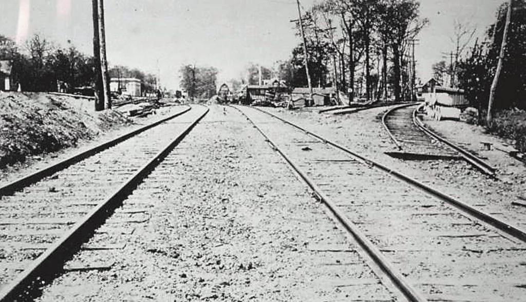
In this photo of the MBRR tracks, Fiske Terrace is on the far right, and Avenue I looms ahead, where the Brighton line will parallel the MBRR on its western flank to the shore.
The insurance map above (pink=brick & yellow=wood buildings) shows the eastern spur of the MBRR bending to join the embankment just south of Avenue I. The western spur is long gone.

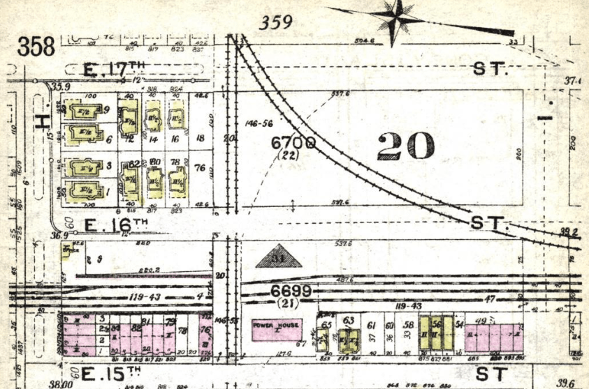
Insurance map above shows Avenue H to Avenue J, from E 15th St (L) to Ocean Avenue (R). A lot of open space that would be filled after the 1939 LIRR sell-off, as will be explained in Part 4.
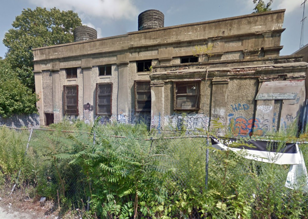
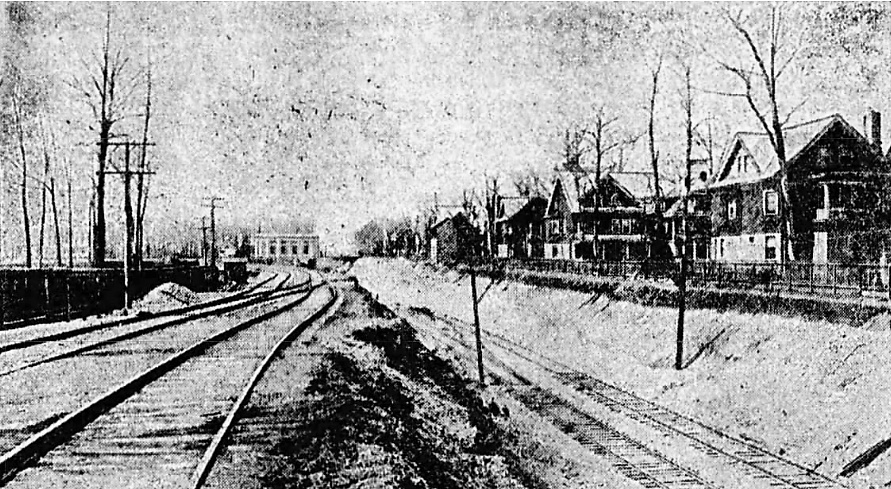
Above: looking east from East 15th Street to the abandoned power station straddling the Brighton tracks behind it. A new power station (not shown) sits to its immediate north. Soon to be condos?
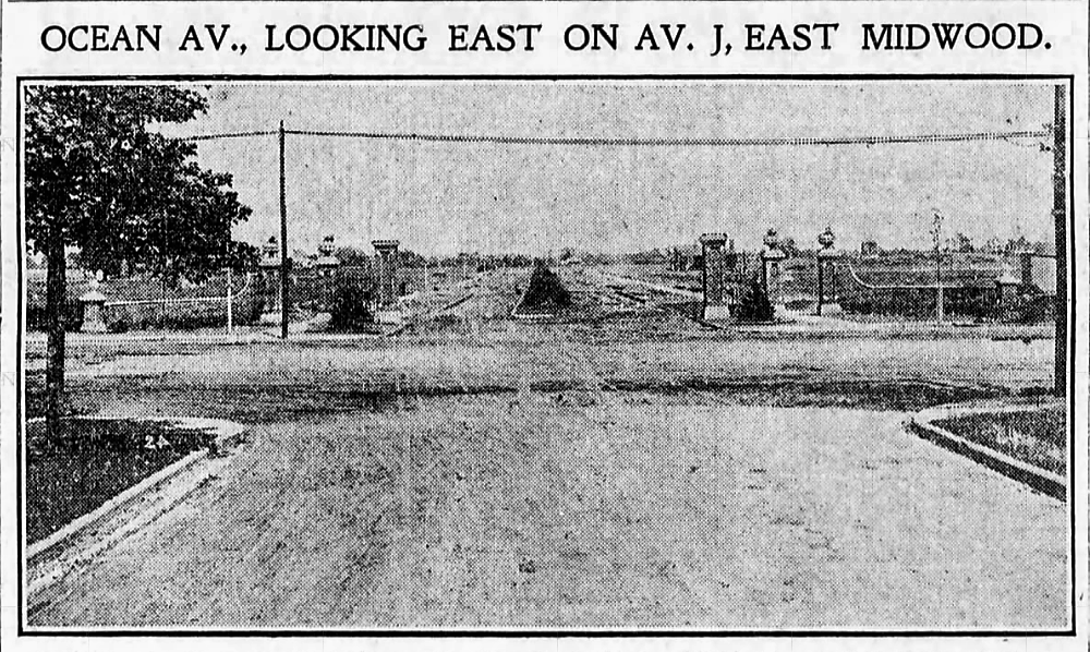
AVENUE J (Originally Manhattan Terrace)
In a familiar pattern, the BRT, in the aftermath of its 1900 electrification of the Brighton line, established another stop in an area that was just about to be developed.
The new realtors dubbed the 700 lots east of the Brighton line to Ocean Avenue, extending from Avenue I to Avenue M, “Manhattan Terrace,” because: 1) it was near the junction of the Brighton and Manhattan Beach Railroads; and 2) they wanted to emphasize that the nearby transit offered multiple options to get to Manhattan.
And so in 1902, the BRT shared a station house with the MBRR here, despite the fact that it wasn’t a stop for the Manhattan Beach crowd. But that didn’t stop the developers from claiming access to the railroad in their ads, talking up the prospect of a one-seat ride from Avenue J to “33d St. & B’way in 25 minutes” thanks to a new LIRR tunnel under the East River. The ads below grandly called this station “The Manhattan Terrace Union Depot.” Get over yourselves, developer dudes!
Another reason for building a station here might have been the Shults Driving Park (formerly Deer Foot Park) which featured harness racing. It occupied most of the land between Coney Island Avenue and Ocean Parkway, extending south from just below the LIRR Bay Ridge line tracks, past Avenue I to Avenue J. But it had long been eclipsed by other racetracks further south and would be sold off to other developers in a few short years. Midwood Manor would spring up there in 1909.


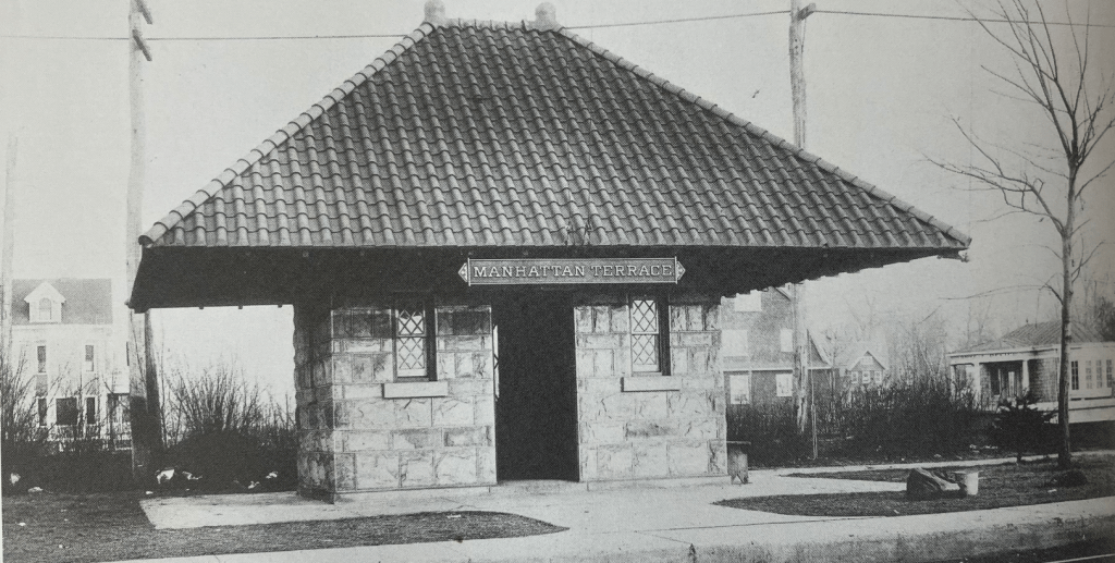
The Manhattan Terrace Improvement Company built this station alongside the MBRR tracks on the eastern side of the roadbed, just beyond Avenue J. It was on their property but distant from the Brighton platform, which is where trains stopped. Anyway, it became toast in 1907 when the embankment arrived.

Above, looking north on the Brighton roadbed. The MBRR tracks are on the very far left where the fancy station sat. I wonder how many travelers sheltering there died trying to cross over the tracks to reach this Brighton platform.
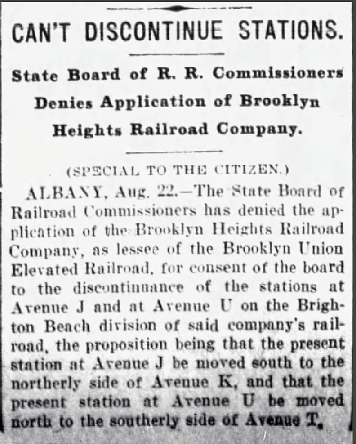
Perhaps the BRT desire to relocate to Avenue K (per news clip above) was in anticipation of Wingate Field, which opened in April 1908 as the home of the Public School Athletic League, alongside the newly raised railroads southward from Avenue K. Fun Fact: The grandstands and field house were built in 1912 on land donated by the LIRR — it was their MBRR trackbed until the grade crossing project was completed. Wingate, of course, was renamed Midwood High School Field in 1955, when the school acquired it.
Above: looking north from Brighton tracks to Avenue J – an MBRR southbound locomotive can be seen on the far left, with the never-helpful Manhattan Terrace stationhouse dead center in the distance.
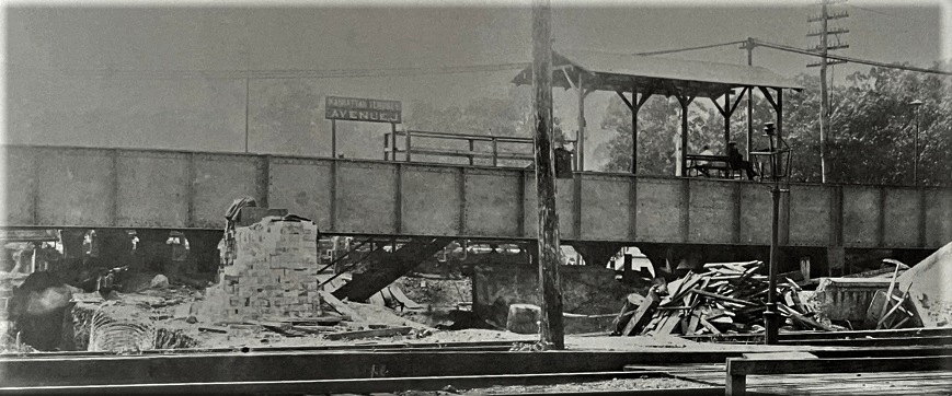
Above: looking northwest from the MBRR tracks to the Brighton station. Another trestle will be placed alongside the east side of the one we see here so the two MBRR tracks can share the embankment. The sign in the center reads “Manhattan Terrace AVENUE J,” but within two years the Terrace will be toast as the BRT standardizes its nomenclature. Gone also are South Midwood, Fiske Terrace, and Greenfield, replaced by their BOR-ING alphabetic locations. Less confusing for riders, of course.
Above: looking southwest to Manhattan Terrace station from the MBRR tracks, then still in place.
Above: looking due south along what had been the roadbed of the MBRR. A new trestle has just been placed over Avenue J on the right, where the MBRR trains will speed by, once construction of the elevated embankment is completed.

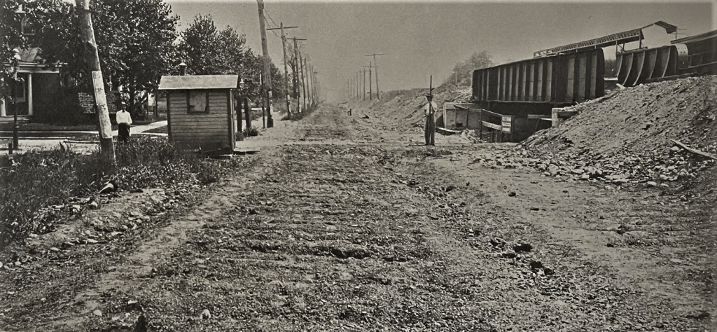
Above: looking east from East 14th Street to new trestles over Avenue J. Note how the street slopes down to pass under the trestles. The stairway to the southbound Brighton train is on the far right. Mass transit elevators for the disabled were not even a concept back then. While Avenue H and Kings Highway have now become accessible, not yet for Avenue J and Avenue M. Full confession: not an issue I cared much about until my wife was unable to climb such stairways.

Above: looking southwest from Avenue J along the former street level location of the MBRR roadbed.

Above: looking northeast to the Manhattan-bound platform of the Brighton local stop. The express tracks are in the foreground and the camera is stationed on the Brighton-bound local platform. On the extreme left center, one can see the MBRR trestle – its trains didn’t stop here.
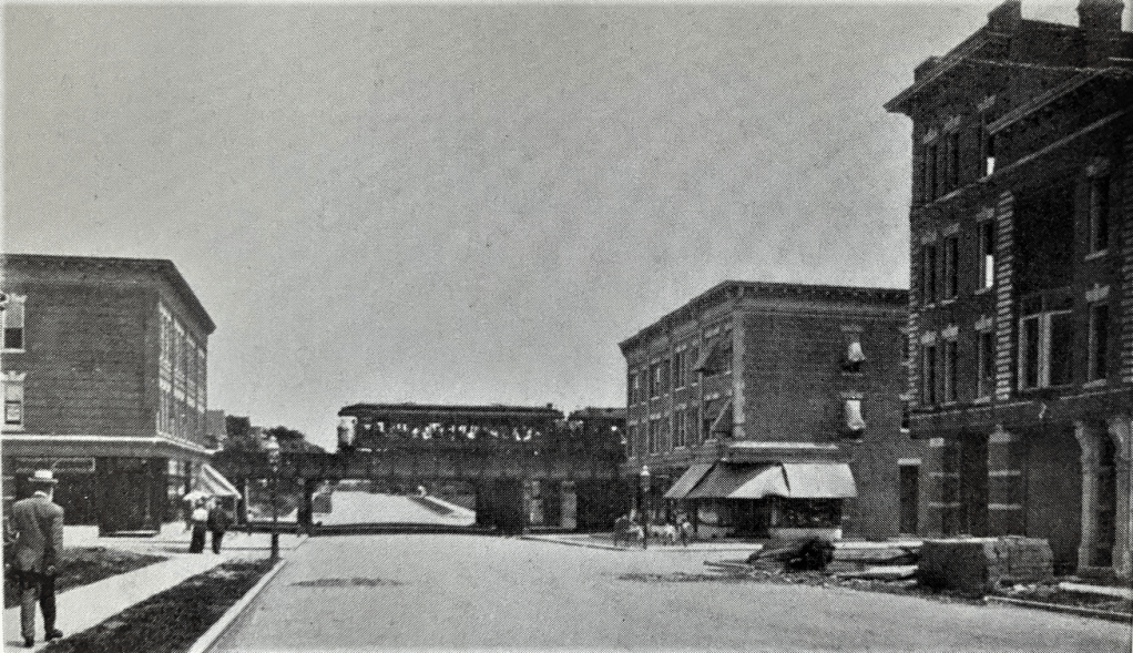
Above: Avenue J looking east toward E 15th Street. That train looks crowded!

Midwood Manor was another development contributing to the prevalence of “Midwood” to describe the wider area south of the LIRR Bay Ridge line to Avenue M. Manhattan Terrace survived as the name of a neighborhood association for another twenty years but by World War II, this entire area north of Kings Highway would be more popularly known as Midwood.
In a 1908 promotional gimmick, the Midwood Manor developers (Wood, Harmon & Co.) offered $1,000 to anybody who could come up with a better name. The 1920 postcard above attests to the fact that nobody won. As we will see, this is the same gimmick they used further south on the Brighton line six years earlier.

For more on the origin of “Midwood” neighborood names, you might enjoy this breezy escapade.
Avenue M (Originally South Greenfield, Greenfield, and Elm Avenue)

From 1851 to 1854, the United Freeman’s Association purchased mucho acres of farmland stretching east-to-west from today’s Coney Island Avenue to McDonald Avenue, and from 18th Avenue south to Foster Avenue which they dubbed Greenfield. Then in 1854, the Association, a rural forerunner of real estate development companies, bought up more land to the south, bounded by Avenue L to Avenue N, from Coney Island Avenue west to Ocean Avenue. They called it South Greenfield. Duh. By 1870, the citizens of Greenfield had changed their name to match their new post office, Parkville, and thereafter most of the inhabitants around Avenue M, many of them Irish farmworkers, were happy to be known simply as Greenfield boyos, irrespective of weathervanes.
Anyway, the Brighton line referred to this stop – at the intersection of Elm Avenue and Avenue M – as Greenfield, while the MBRR, used mostly by out-of-towners so to speak, preferred South Greenfield, being out of touch with local norms. The trains originally would stop here on signal, but then a small station was built to accommodate the growing ridership.

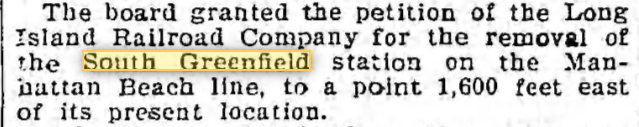
In 1899 the LIRR was given approval to move its South Greenfield station about a third of a mile east of the Brighton line, which would have placed it at Ocean Avenue. However, I could find no reports that such a move actually happened. Indeed the photos below from 1906 show the two lines were still relatively close. Of interest, the closest grade crossing eliminations occurred in Greenfield as the railroads required bridges over Locust, Chestnut and Elm Avenues, a distance less than 400 feet. But only Avenue M reached Ocean Avenue. Hmmm…Was the LIRR trying to eliminate some of its grade crossings?

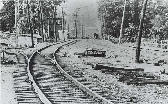
The photo above shows the MBRR tracks on the right looking south and the Brighton tracks far left. At this time, Brighton cars were temporarily using the Manhattan Beach tracks. On the far right center is the platform for the South Greenfield station. The BRT had electrified their line via trolley wires but the LIRR had not, so the Brighton cars had to be pulled by locomotives when using the Manhattan Beach tracks.
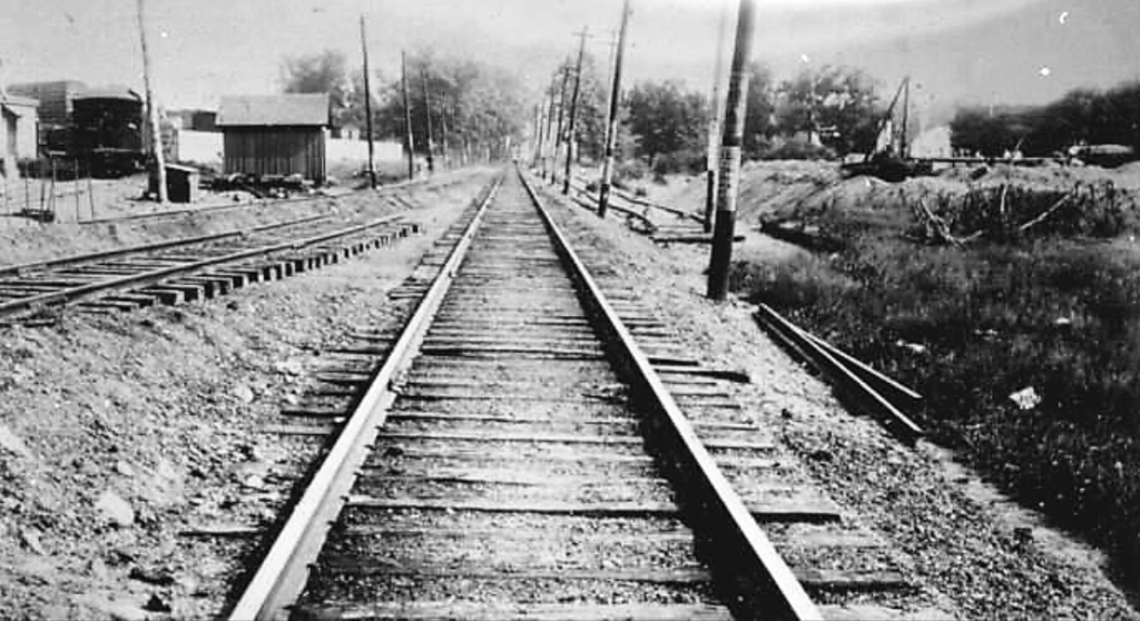
Photo above is looking south on MBRR trackage from Elm Avenue. The work to bring the two railroads closer together had just begun.
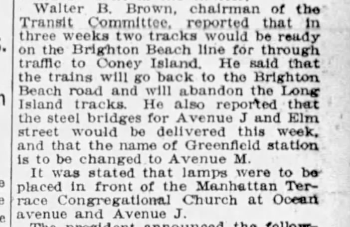
In 1907, during the grade crossing eliminations, Brighton trains would use the MBRR tracks and vice-versa while the roadbeds were being moved, per the news clip above, which also reports the station re-naming as Avenue M.

In 1906, Vitagraph Studios set up operations on the land adjoining the west side of the Brighton tracks, churning out hundreds of films until it closed in 1939. Its smokestack still stands at Locust Ave & East 15th Street as an enduring reminder of the pioneering film studio that once thrived there. Incredibly, the New York City Landmarks Preservation Commission and the National Register of Historical Places have never recognized the Vitagraph smokestack. Hats off to the developers of the Vitagraph Apartments for preserving it. Of course, it doesn’t hurt to have such a visible signpost for your complex!

Above: looking south from Chestnut Avenue on the MBRR tracks. Work on the embankment on the right continues. The old station platform is on the left.

Above: looking west from East 17th Street along Locust Avenue. The Vitagraph Studios smokestack was erected on Locust Avenue near East 15th Street (see additional photo below).
Above: Vitagraph filming on Elm Avenue & East 15th, looking east on Elm. One can see the separation between the two trestles in the upper background. The Brighton one is closer to the camera and is wider, carrying four tracks, compared to only two for the MBRR.

Photo above shows the Vitagraph Studios, as seen from the MBRR tracks, looking southwest.

Above: Vitagraph Studios looking east from a balloon or perhaps a small plane. Smokestack visible on upper right, alongside Locust Avenue.

Locust Ave at E 15th alongside the new Vitagraph apartments, looking east to the base of the Vitagraph smokestack, the Brighton trestle and Murrow High School beyond it. Looks like two Murrow students, lower center, might be necking. Sorry, teen dudes!
Well, that’s all for now. Kings Highway, Avenue U, Neck Road and Sheepshead Bay are up next. These episodes are taking longer than I anticipated, trying to verify dates and locations and searching for news stories to fill in some blanks and provide background. In the meantime, you might want to check out a much shorter piece on a mysterious Avenue M photo.
