

When we last left this thrill-packed saga, featuring photos from the Brooklyn Grade Crossing Commission, the Railroads, and their contractors, we were stuck at Beverley Road.
(BTW, “Beverley” is the official name of the street, not “Beverly,” despite the lovely 1920 IRT station signs at Beverley & Nostrand.)
Also, a slight correction to Part 1 wherein I’m sure you’ll recall my assertion that many of the photos stemmed from a lawsuit by the Brooklyn Rapid Transit (BRT) against its contractor. In fact, the contractor was stiffed by the BRT, which caused him to sue the railroad, so sue me.

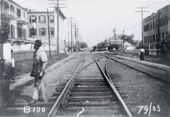
We now continue south, but the trip to Cortelyou Road doesn’t take very long.
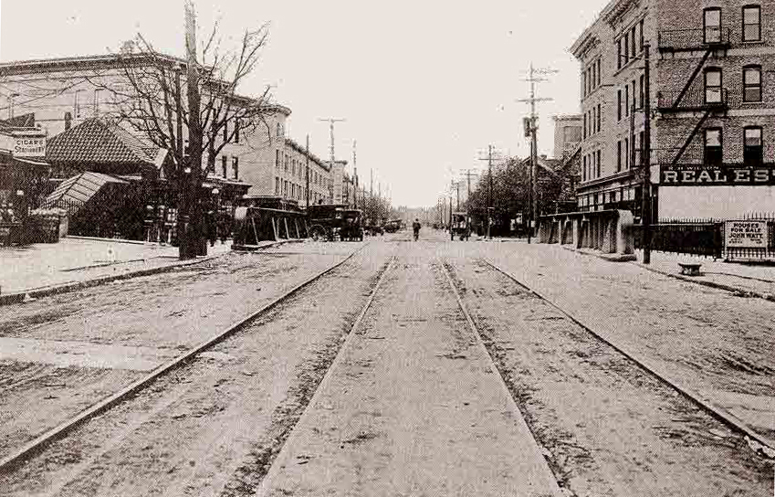
CORTELYOU ROAD

It’s been said that the last car of a southbound Q train will just be departing the Beverley station when its first car is entering Cortelyou Road, a block away. The reason why those stops are so close together is attributed to Dean Alvord’s salesmanship (see Part 1). An urban legend I’ve heard in Ditmas Park saloons claims a BRT bigwig lived near Beverley Road and wanted a stop he could stroll to in a minute or so but I’ve never been able to confirm that, possibly because I spent too much time in those saloons.
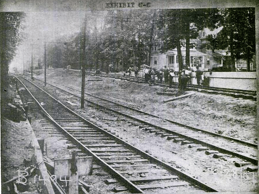
In any event by 1904 the moguls were regretting their concession to Dean Alvord five years earlier, granting him a stop at Beverley Road in his new Prospect Park West (PPS) development. While that decision seemed profitable in 1899 — after all, Alvord’s new buildings would soon be populated with new customers — things change, especially when a new Grade Crossing Commission is telling you to dig a 16 foot trench from just south of Church Avenue all the way to Glenwood Road. The moguls couldn’t just erect wooden shacks down there, by golly. Serious money would be involved. So when the PPS bigwigs revolted at the thought of their stop disappearing and started garnering support from the Commission, the BRT tried to bargain.
“How about if we make Cortelyou Road an express stop in exchange for losing Beverley?” The old fiendish divide-and-conquer ploy. In my estimation the BRT’s offer was hollow. Once Beverley Road was toast, they would simply announce that Newkirk Avenue had to be an express stop (more on that later), so tough luck, Cortelyou. But the emerging settlers in Beverley Square and Ditmas Park sided with their northern neighbors and Beverley Road was saved.
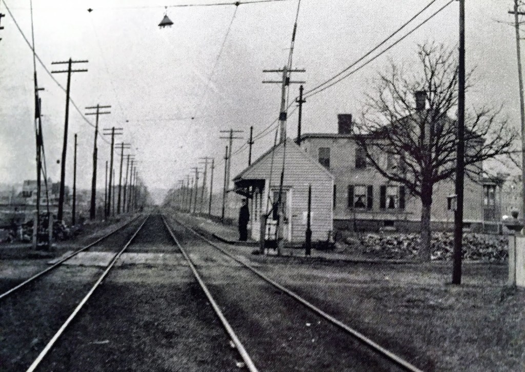
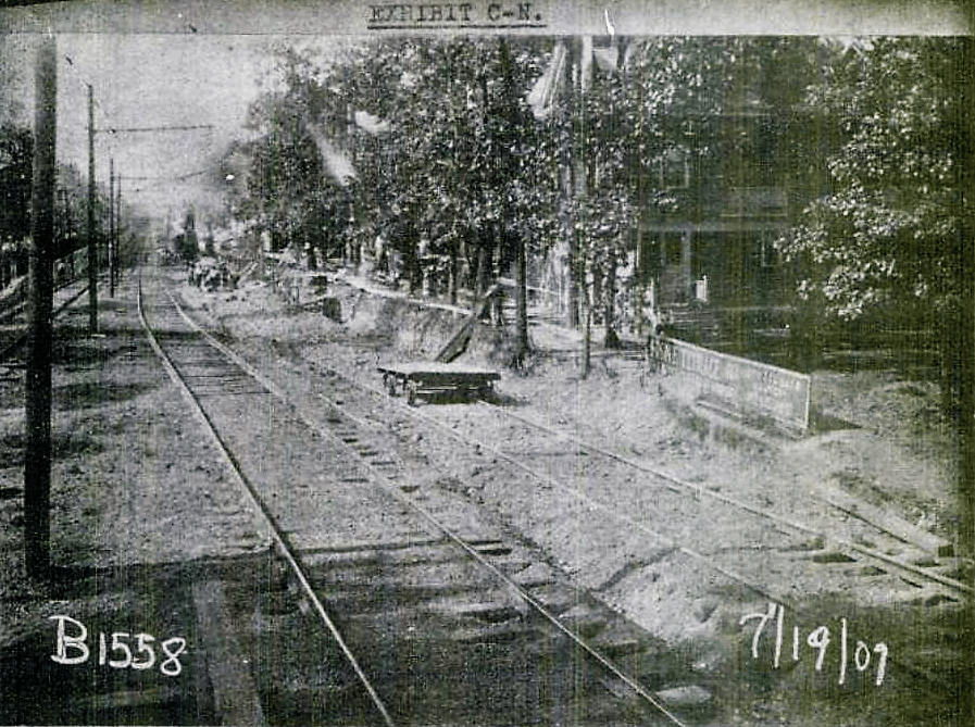
The shop-keepers on Cortelyou Road were disappointed, however. After all, unlike Beverley Road, they had an important electric trolley line running east to west, uniting East Flatbush and Vanderveer Park with Kennsington, making Cortelyou Road an important transfer point. But the Cortelyou station lacked the space for a buildout of two express platforms (see Newkirk Avenue discussion below), so tough luck.


NEWKIRK PLAZA

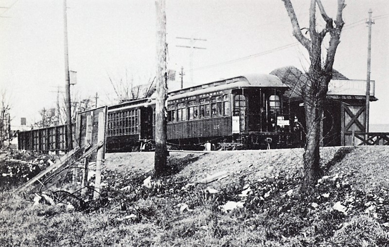
This location was one of the original stops for the Brighton locomotives in 1878. Why? Because there were paying customers in a nearby village to the west, first called Greenfield and you can read a lot about its origin in a recent brilliant monograph but for now, let’s just point out that by the 1870’s the village had adopted the new name of its local post office, Parkville (to cut down on misdeliveries?). And so the Brighton way station here in 1878 was called Parkville. That name lasted only until the Germania Real Estate & Improvement Company, the developers of Vanderveer Park in East Flatbush in the 1890s, completed the last piece of the jigsaw puzzle we now know as Victorian Flatbush. In 1898, Germania (its principals were all first and second generation immigrants from Deutschland) bought 100-odd acres from the heirs of John A. Lott, the patriarch of the Brighton Railroad who died soon after its inaugural run in 1878. This huge swath of land lay west and south of Vanderveer, extending from Flatbush Avenue to the east, Coney Isalnd Avenue to the west, Foster Avenue to the north and Avenue H to the south.

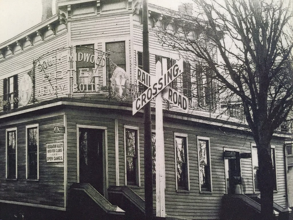
Germania needed a catchy name for this new area. They settled on South Midwood.
Huh? But that area is north of Midwood, isn’t it? Some history music, maestro, to explain their choice.
A 1667 British colonial document noted that the village of “Middlewout” or “Midwout” was also known as “V’lacke bos” to the Dutch, which sounded like Flatbush to English ears. It described a settlement centered around a church located at today’s intersection of Flatbush & Church avenues. Thus, Midwood Street isn’t located in today’s Midwood, but in old Flatbush/Lefferts Gardens. Moreover, numerous maps establish that the southern boundary of the town of Flatbush, aka Midwout, is today’s Foster Avenue. By the 1898 consolidation of Brooklyn into New York City, those town boundaries were essentially meaningless, so Germania had a whole host of possibilities to select from: South Flatbush? West Vanderveeria? Central Flatlandia?
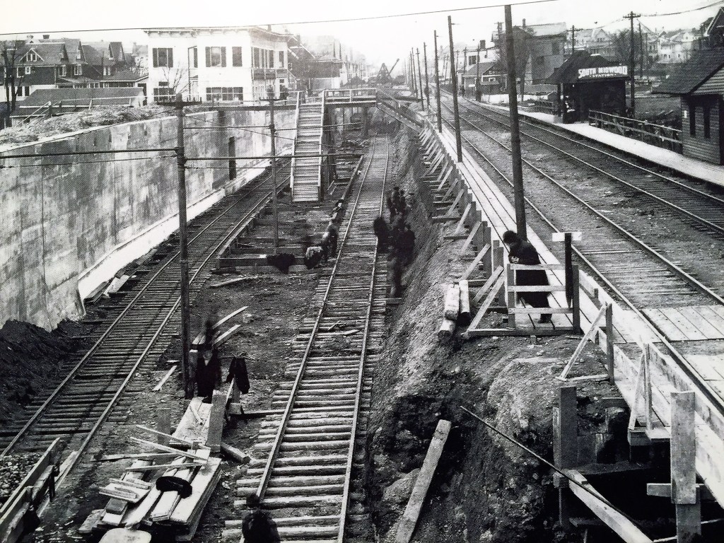
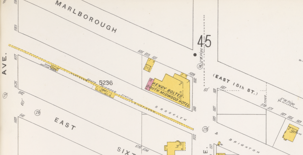
A June 1900 fluff news piece described Germania’s Eureka moment: “This new section [needed] a name which would indicate its character and be a prophecy for the future…Time and thought were given to the cracking of this nut. At length, however, patience and perseverance did their perfect work and the euphonious, historic and suggestive designation of South Midwood was adopted…As the locality in question is the extreme southern part of the old Dutch town Midwood, the new name recalls the past and indicates where the suburb is situated.” [Emphasis added.] It certainly sounded more bucolic than South Flatbush. And so, by1901 the BRT had adopted South Midwood as the new name for its stop at Newkirk Avenue, although technically it was closer to West South Midwood.


Why Was Newkirk Selected as the Express Stop? And What’s Up With That Plaza?
The answer to these two questions are completely interdependent.
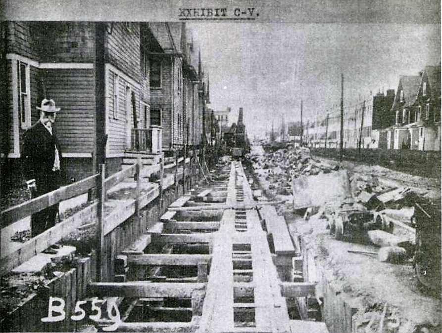
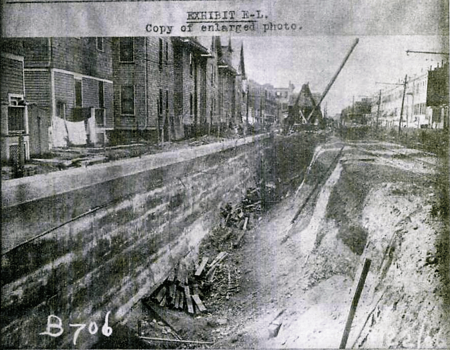
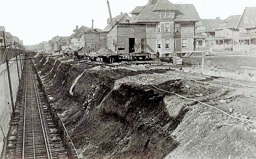
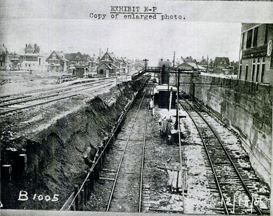
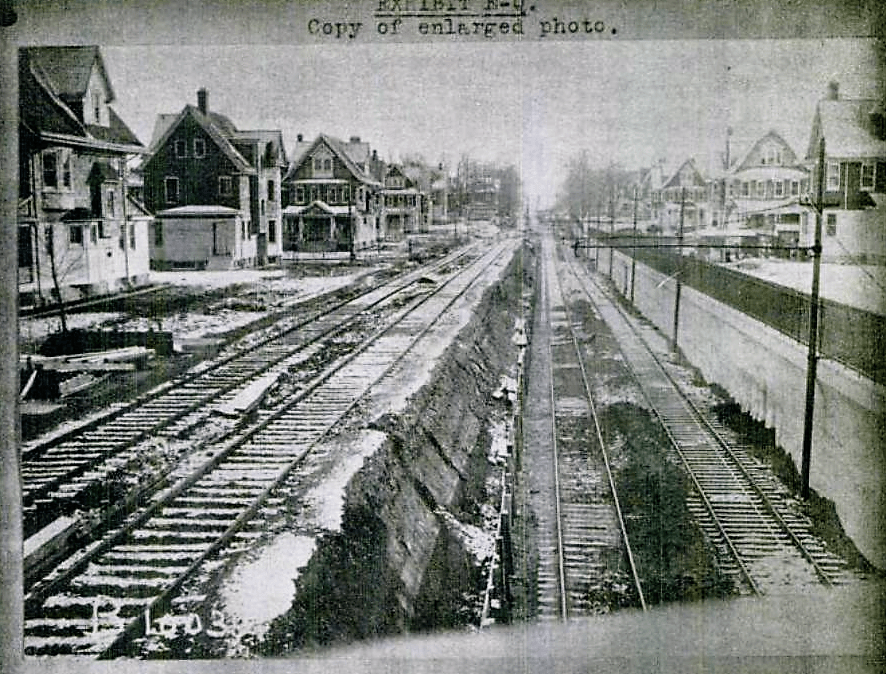
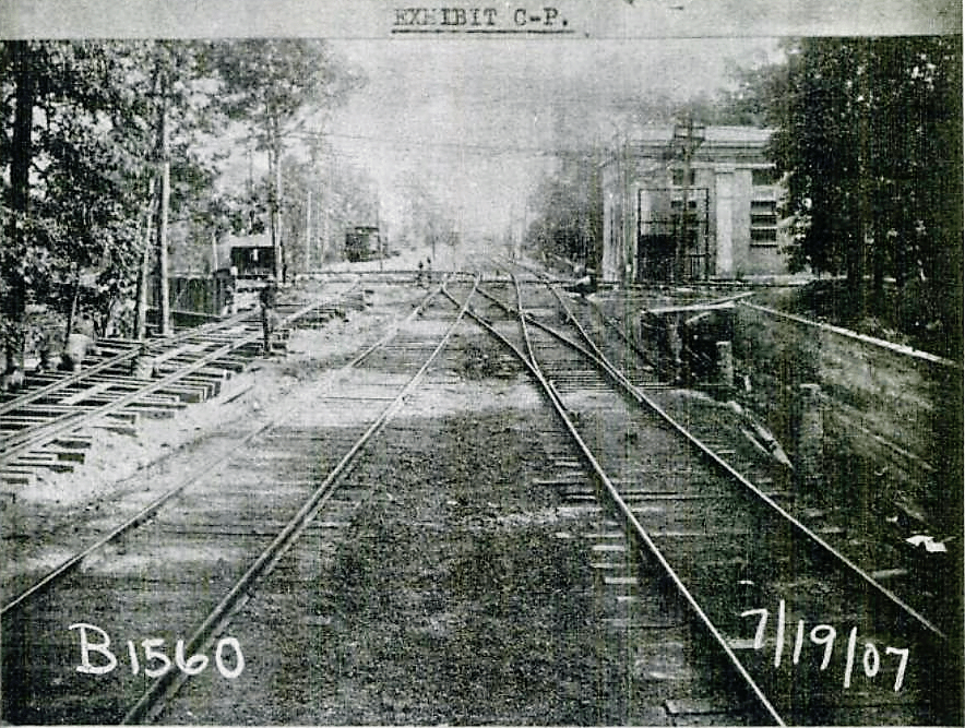
In 1903, Brighton line riders had two demands: a depressed railroad to avoid problematic grade crossings, and express stops. But the right of way south of Prospect Park was only 50 feet wide and building additional express tracks (all powered by third rails) would require a wider path. The Brooklyn Rapid Transit Company threatened to abandon the express tracks dream, and build an ugly, noisy, and much cheaper elevated line instead. Negotiations ensued and Flatbush property owners abutting the railroad agreed to give two foot surface easements on each side of the right of way if the BRT would agree to the trench. Inasmuch as the Brooklyn Grade Crossing Commission agreed to pay half the cost of the project out of City coffers, the BRT consented.
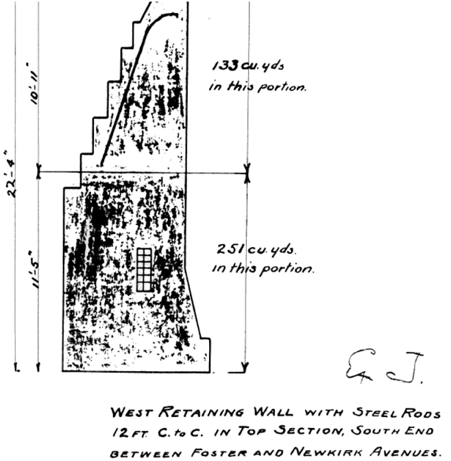
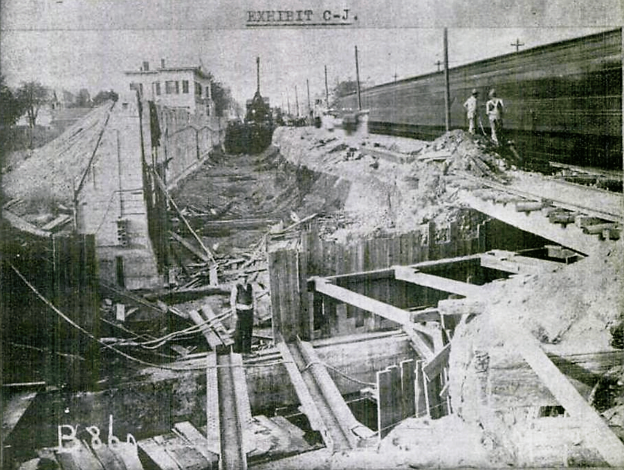
But there was a second problem. To add an express stop, the railroad would need an additional 20 feet on each side of such a station. South Midwood was the only practical location available because in 1906, there were few structures between Newkirk and Foster Avenues: no buildings to knock down.
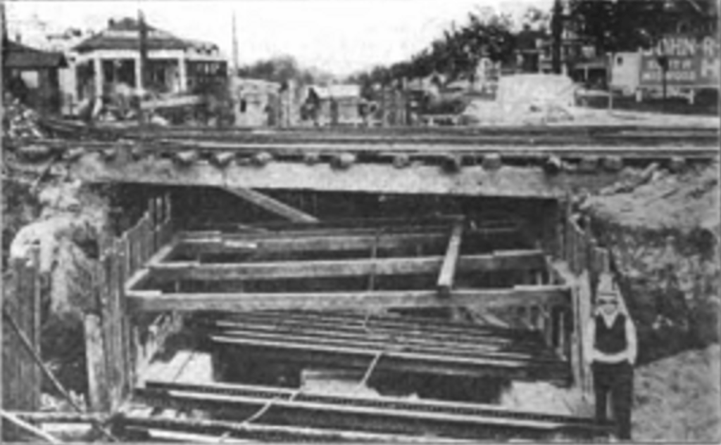
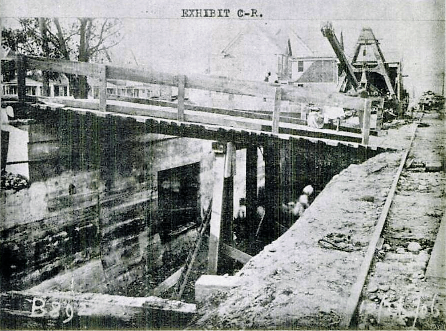
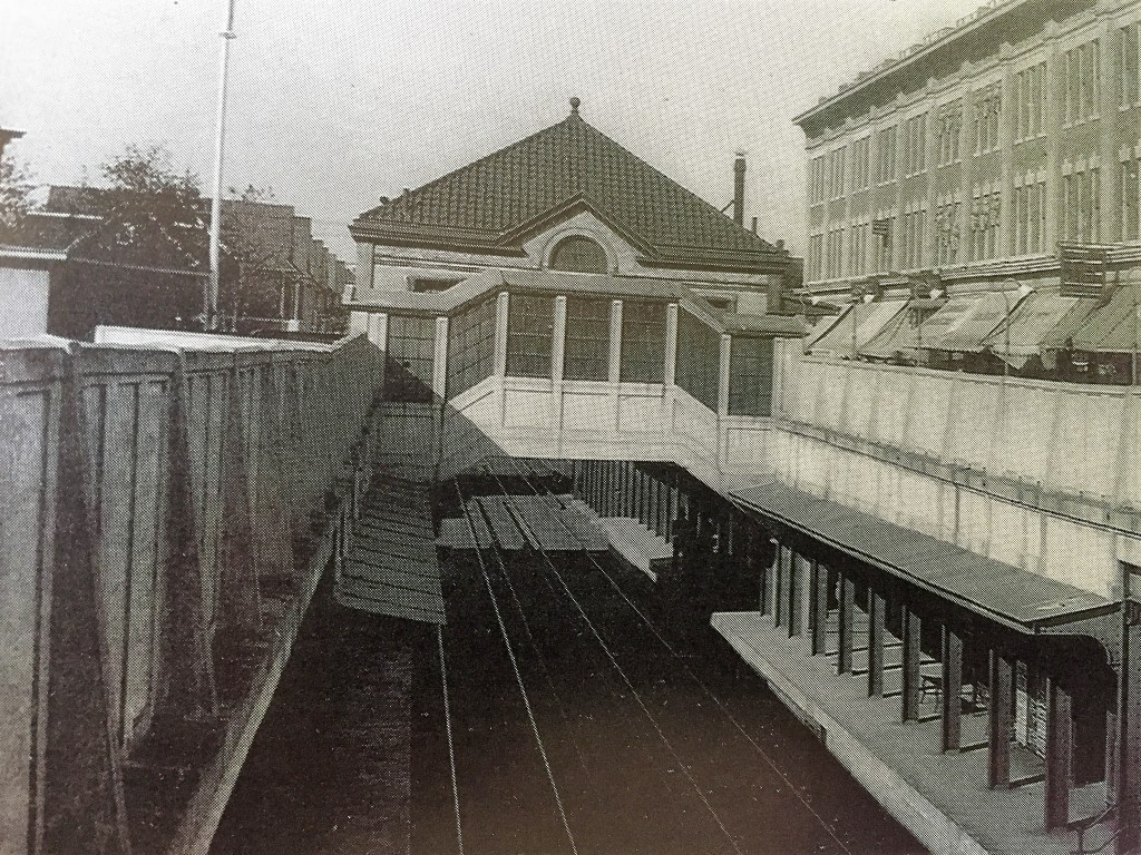
When the BRT agreed to restore the Newkirk property owners’ easements by constructing a concrete pavement – level with the surface of the ground above the cut, forming a partial roof over the local tracks below – they had a deal.
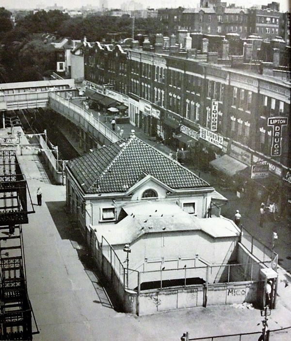
Enter the Interborough Development Company. Formed in April of 1906 by seven otherwise unremarkable realty entrepreneurs, Interborough realized that the unroofed center above the express tracks would not leave enough room for a pedestrian sidewalk AND for wagons/trucks/autos to access the front of the commercial buildings they wanted to build. So it would have to be a pedestrian-only venue. What to do? Enter a local resident, C. F. Bond.
Charles Francis Bond was the brother-in-law of T.B. Ackerson, who built large swaths of Beverly Square, Fiske Terrace and West Midwood. Bond himself had become active in the Newkirk area, erecting a number of homes on East 18th Street in Fiske Terrace and his own home in Ditmas Park on East 17th Street, all in districts later landmarked by the City. Bond was trained as an engineer and worked for several railroads before forming his own construction business. He had a solution for the Interborough landowners because if there was one thing he knew more than construction, it was railroads. Newkirk Avenue will be an express stop? Then why not leverage the pedestrian traffic that it will attract?
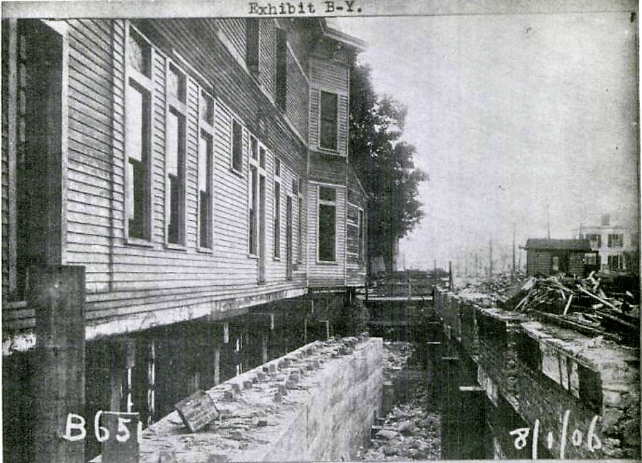
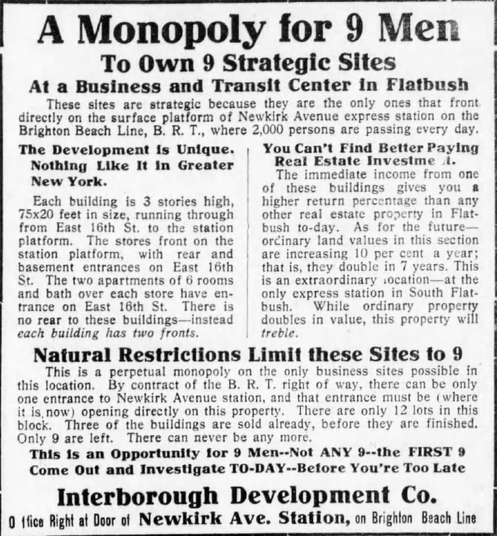
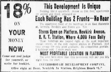
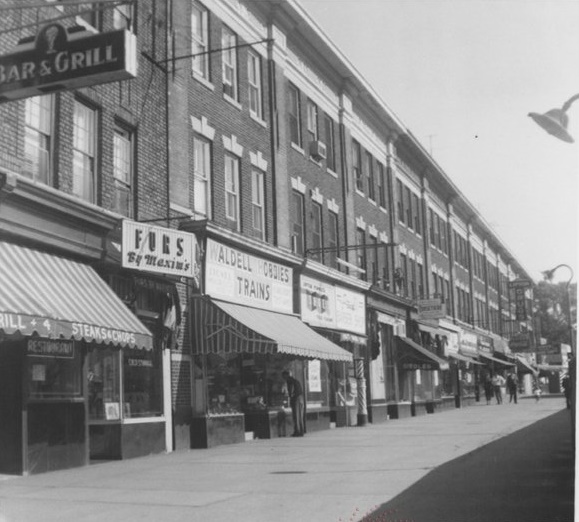
And so, in February of 1910, an advertisement appeared in Brooklyn newspapers. Interborough was selling 12 attached brick buildings, three stories high, their basement walls forming the eastern wall of the new underground express station at Newkirk Avenue. But these weren’t just ordinary buildings with stores on the first floor and apartments above, oh no: “This Development is Unique! Nothing Like It In Greater New York!”
Indeed, its uniqueness was perhaps best illustrated by how much the ad struggled to describe it. At one point it claimed the stores “front directly on the surface platform,” and at another point the stores are said to “front on the station platform.” In breathless fashion, the ad continued: “There is no rear to these buildings—instead each building has two fronts!” It described one front was for a store, opening at the station, and the other front was on East 16th Street where the apartment dwellers and deliveries would enter. Another major feature which made these buildings so attractive: “By contract of the BRT right of way, there can be only one entrance to Newkirk Avenue station…where it is now, opening directly on these properties where 2,000 persons are passing every day.”
Bond’s genius was to realize that by eliminating residential doors and staircases, wider storefronts could be built, allowing the owners to charge higher rents, but also making the streetscape more attractive. Indeed, the new shopping plaza was an instant success.
For more on the history of Newkirk Plaza, there is a slideshow some shady guy created on YouTube with more verbiage about the Plaza, 1940s-Present, on an Argyle Heights blog post.
AVENUE H
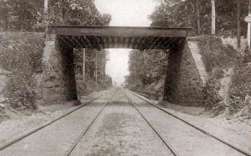
And now we come to the fork in the road, so to speak. When the Bay Ridge line of the LIRR was built in 1877, it passed through mostly empty farms and woodlands, from a ferry pier at 65th Street to East New York and beyond. John A. Lott, of Huguenot Dutch ancestry, gave the owner, Austin Corbin, of Master-of-the-Universe ancestry, a free pass through his land, which extended from today’s McDonald Avenue to Flatbush Avenue. And yet another free pass for a spur extending south of this line that Corbin dubbed the Manhattan Beach Railroad (MBRR). The spur began just east of Ocean Avenue near today’s East 18th Street & Avenue H, and cut diaganally to Avenue I & East 16th Street before heading south for Corbin’s new luxurious Manhattan Beach Hotel. In return, Corbin gave Lott a free pass for his Brighton Railroad, about to begin construction from Prospect Park to Lott’s new luxurious Brighton Beach Hotel. By the way, Lott sold to the Brighton railroad — while he was President of the company that owned it — the right of way through his land. How much? Unknown.
In 1878, when the new Brighton road reached the Bay Ridge mainline, just south of Avenue H between today’s E. 15th & 16th Streets, it was forced to tunnel under Corbin’s railroad. It then reemerged and traveled on a straight line, a block east of the MBRR but parallel to it, all the way to the shore. (More on that in our next installments.)
It’s not often you can find documentation for something that happened 125 years ago in a slimly populated section of Kings County, but if you have time to waste, you can get lucky. In researching the origin of a stop at Avenue H, I realized I should search for the first known name of a station there, Fiske Terrace. But when did Fiske Terrace come into existence? As it turns out, a real estate swell named George Fiske who had a place on Montague Street in Brooklyn Heights decided to buy a mansion for him and the Mrs in the suburbs. So he looked around and bought a house in Tennis Court, a development off Ocean Avenue between Albemarle Road and Church Avenue. But he musn’t have liked it because he explored further south down Ocean Avenue and found a lot of vacant wooded land between Avenue G (soon to become Glenwood Road) and Avenue H (soon to become Hiawatha Road, but sadly that didn’t stick), west of Ocean Ave to the Brighton Tracks. He bought all of that land in 1896 and built his home on the hilliest slope there.

Then he started to sell off the land. Although there was a new-fangled electric trolley on Ocean Avenue that connected Crown Heights to Coney Island, he wanted a connection to the Brighton line, which would allow access to Manhattan, thereby increasing sales. Somehow he must have convinced the railroad folks, just like Dean Alvord two years later, because in April 1897 we found ths note in the Brooklyn Daily Eagle:
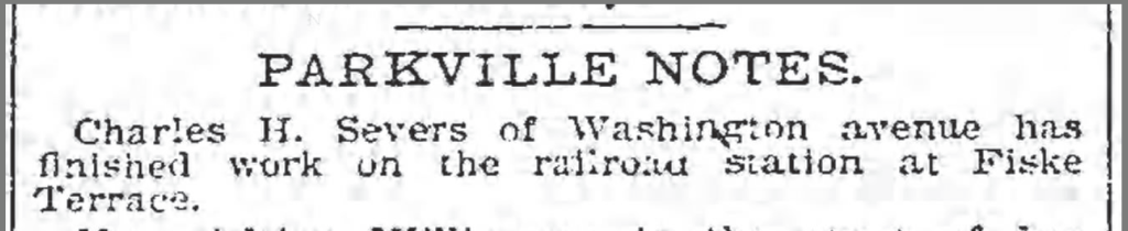
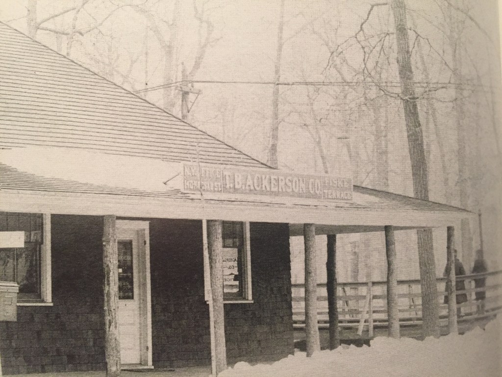
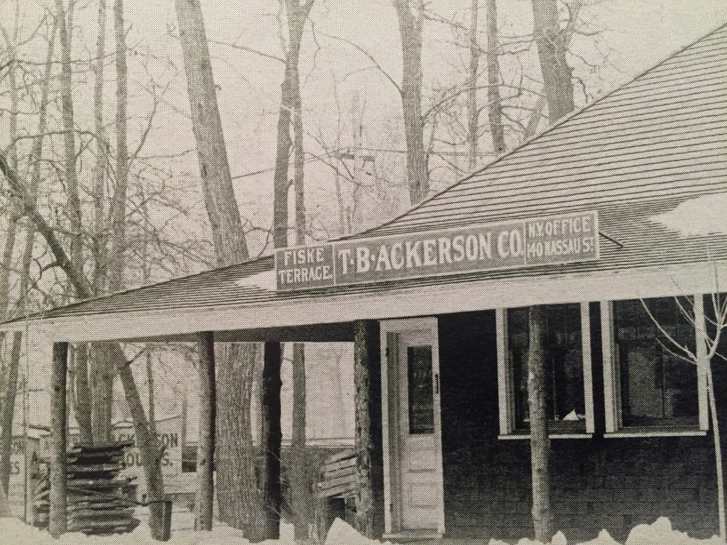
Here’s what Charles Severs of Parkville built for George Fiske:
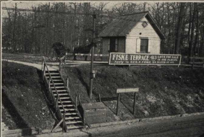
In the photo above, the sign posted by George P. Fske — who named Fiske Terrace in his honor — lets you know there are 413 plots left to sell. It seems between 1897 and 1903, sales weren’t going well. Perhaps the “Panic of 1896” and the subsequent recession played a part. But then along came T. B. Ackerson, who bought ALL those lots from George. For some reason, T.B. didn’t change the name of his new development to Ackerson Terrace. More on Ackerson and the other modest builders of Victorian Flatbush can be found on another very long Argyle Heights post.


Wheh! Glad that’s over! But as I finished this episode, I realized there are so many more photos to cover…Manhattan Junction, Manhattan Beach Crossing…all before we get to Avenue J. Yikes! To be continued, assuming anybody’s awake. As always, please point out my many mistakes in the Comments but only three to a customer, please. Thanks for reading.
COMING ATTRACTIONS
Avenue J (Originally Manhattan Terrace…what’s with all these terraces?)
South Greenfield (Should I go into the whole Vitagraph Studios thing?)
Kings Highway (Another express stop…why?)
What stop is this? (Get a grip, dude.)

A long, but great read. Nice photos!
LikeLike
Diane was living on Newkirk ave when we met. She shared the apartment with Janis Ian who was beginning her career with the “Manhattan Transfer”.
The Manhattan Transfer – The Manhattan Transfer [Vinyl Rip] – YouTube https://www.youtube.com/watch?v=qCHwcRHUBgM
LikeLike
Wonderful history photos and writing— thanks Joe for your work on this legacy of the area!
LikeLike