
Before I move on with this historical overview, I need to point out a likely error. Some weeks ago I posted a photo that I found in 2013. I thought it pictured the Avenue M station on the Brighton line. Subsequent research, however, casts doubt on this. First, Avenue M was never used as the station name for Brighton trains prior to 1907. Since the railroad’s 1878 inception, it was called Greenfield. Until 1906 that is, when a tattered 1906 BRT map in the Brooklyn Public Library’s collection showed the stop as “Elm Avenue.”
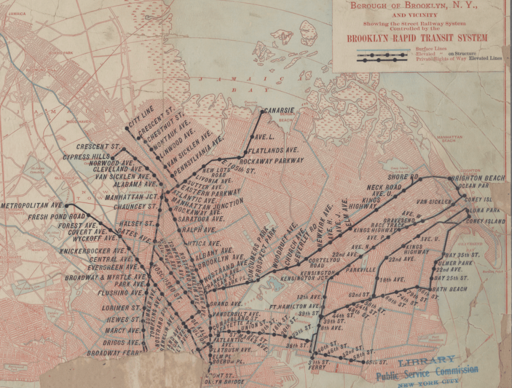
On this same map, above, the Canarsie line is depicted in the upper center. The BRT had just gained control of this line, which descended from elevated tracks in East New York powered by third rails to E. 105th Street near Foster Avenue. Thereafter, it ran via electric trolley wires to Canarsie Landing, on a street-level private right of way between E. 95th and E. 96th Street, parallel to Rockaway Parkway. And one of the stops was “Avenue L”…Well, that’s interesting.
By way of background, that area of Canarsie, bordered on the southeast by Seaview Avenue, was then being developed as “Seaview Terrace.”

Now let’s look at that photo of the Avenue M station again:

Notice the sign on the left hanging from a wooden pole. It is badly faded, but one can make out the words “Seaview Terrace.” Yikes!
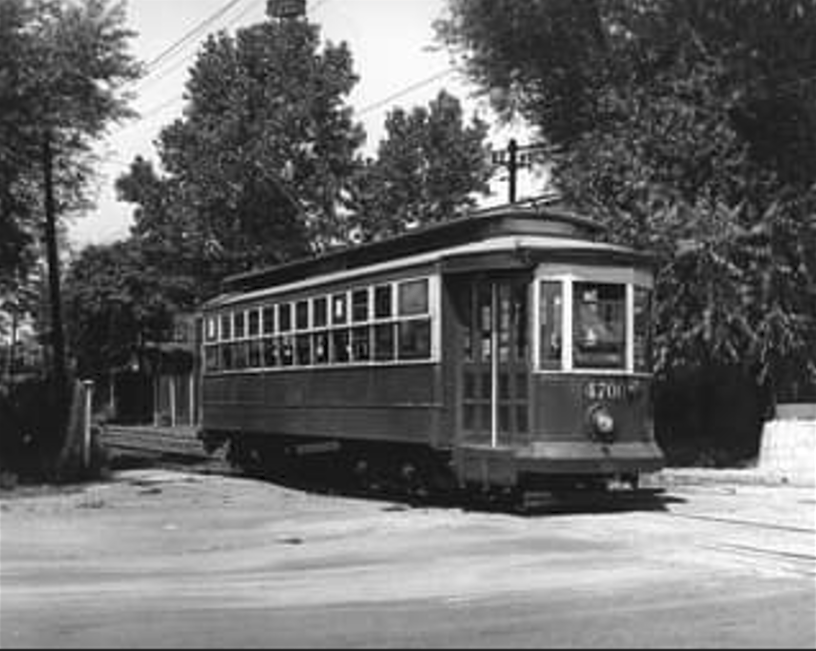
But why didn’t the station sign read “Avenue L” if this was indeed picturing the Canarsie line? ‘Tis a puzzlement, indeed. The Canarsie right of way was abandoned in 1942. But thanks to a trail leading from a FaceBook group called the “Brooklyn Rapid Transit Els,” I eventually found this photo of a trolley, apparently not too far from Avenue L on that long-gone extension to Canarsie Landing (thanks to the George Conrad Collection at https://nycsubway.org et alia):

Notice the wire fencing and white posts behind the rear of the trolley…Now, look at the Avenue M photo again…Hmmm…Looks like I’m a moron again.
My best hypothesis for all this? The Canarsie line, exercising an abundance of helpfulness, posted signs for Avenue M at one end of the trolley stop, and Avenue L at the other. If I’m wrong, please feel free to sue me.
By the way, this research answered another question I was always too embarrassed to ask: “Why are there streets in Brownsville, East New York and Canarsie with the name “Rockaway”? The answer? Those roads led to Canarsie Landing where steamboats once crossed placid Jamaica Bay to Rockaway Beach. Who knew? Not me.

“The Canarsee (also Canarse and Canarsie) were a band of Munsee-speaking Lenape who inhabited the westernmost end of Long Island[3] at the time the Dutch colonized New Amsterdam in the 1620s and 1630s.”
My dad’s sister moved into the “Bay View Houses” well before they were completed. I stayed over one night to be with my cousin Sammy. I must have noticed a certain steam roller as my father drove in. The next morning, I woke my cousin at 5 or 6 AM to drive that steam roller. Fortunately for that development and the lives of many, there was no visible way for me to start the machine.
Though I was 5 or 6 years old at the time my family reminded me of my transgression for decades!
Some day if you have time, you might want to consider investigating the dangerous buses on St. John’s Place. They were electric with overhead wires.
Steve
LikeLike